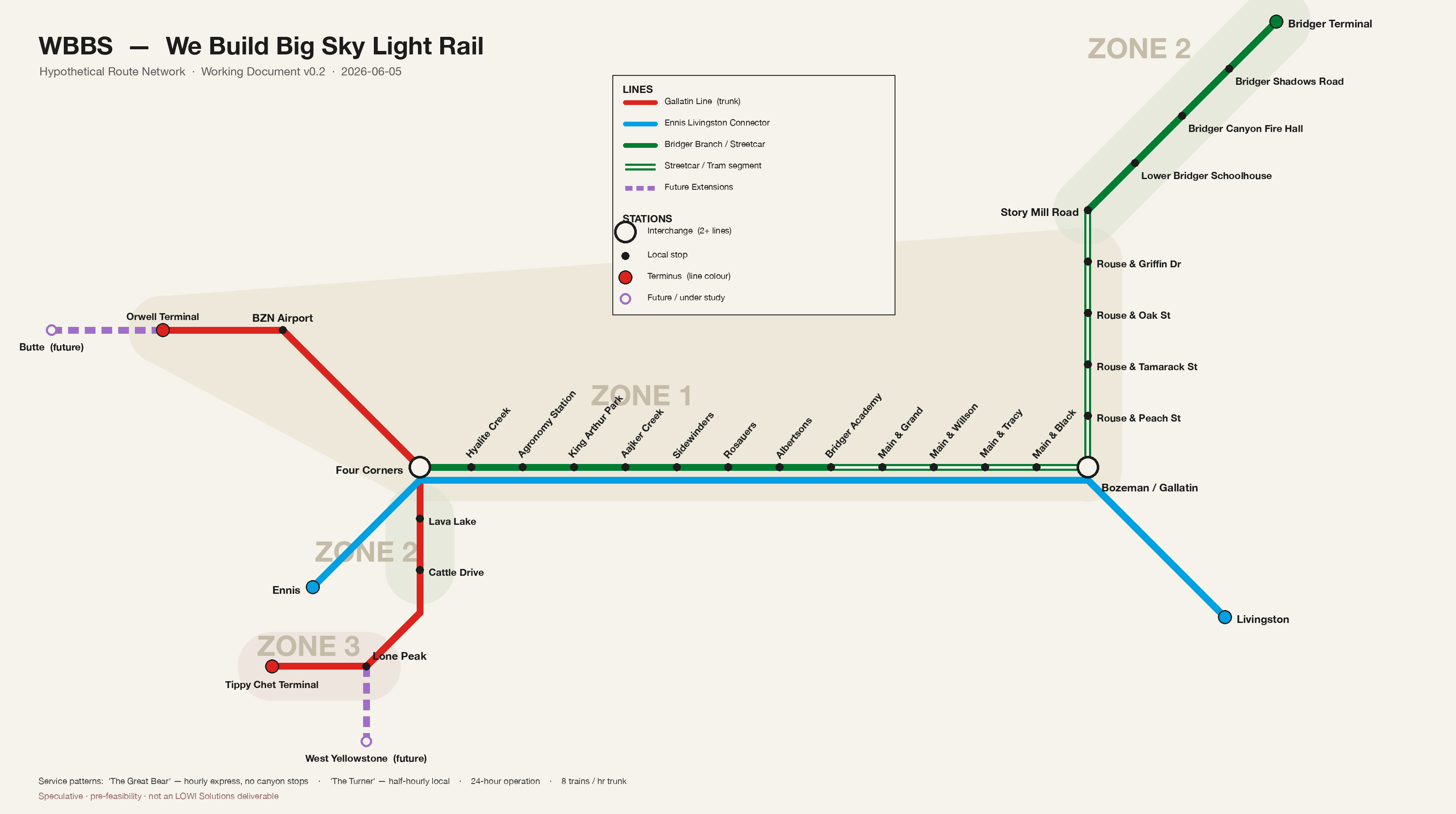
⛶ Click the map to expand it full-screen
4Zones
8Trains / Hr Peak
24hService
6,400Pax / Hr Capacity
Every station, every line, every zone — from Manhattan to Lone Peak, and out to the locals' mountain.
⛶ Click the map to expand it full-screen
| Line | Route | Type |
|---|---|---|
| Gallatin Line | Manhattan → BZN Airport → Four Corners → Canyon → Lone Peak → Tippy Chet | Narrow Gauge Commuter Rail |
| Bridger Branch | Four Corners → Huffine Corridor → Bozeman/Gallatin → S. Rouse → Bridger Bowl | Streetcar + Narrow Gauge Commuter Rail (tram-train) |
| Ennis–Livingston Connector | Ennis → Four Corners → Bozeman/Gallatin → Livingston | Narrow Gauge Commuter Rail |
| Butte Extension | Orwell Terminal → Butte | Narrow Gauge Commuter Rail (Future) |
| West Yellowstone Extension | Lone Peak → West Yellowstone | Narrow Gauge Commuter Rail (Future) |
Two vehicle types run the network: streetcars in town, and narrow gauge commuter rail everywhere else. The Bridger Branch is a tram-train — it's both.
Manhattan, Belgrade, BZN, Four Corners, Bozeman.
Lava Lake, Cattle Drive, Bridger Canyon.
Lone Peak, Tippy Chet Terminal.
Livingston, Ennis.
West Yellowstone, Butte.
The fast one. Runs hourly, BZN Airport straight through to Lone Peak with no canyon stops — under 90 minutes, gear and all. For commuters, airport runs, and anyone who just needs to get there.
The scenic one. Half-hourly, every stop, the whole canyon end to end. Slower on purpose — this is the run you take for the views, the wildlife, and the ride itself.
24-hour operation · up to 8 trains per hour at peak · 800 passengers per service · 6,400 passengers per hour of capacity.
See How to Get Involved →